Making a GIS and Digital Map Platform Buildable at Scale
Nexora ran business analysis on a live 3D/360 digital map platform, then assessed the architecture for a parcel-map and asset-valuation GIS.

Making a GIS and Digital Map Platform Buildable at Scale
Kết quả
The Challenge
Digital mapping projects fail on data decisions made early, not on the map widget. Indoor 3D models and outdoor maps sit in different coordinate systems. Administrative boundaries changed during operation when Vietnam moved from 63 to 34 provinces in July 2025, so old records had to stay searchable under the new structure. Survey data from drones and laser scans is heavy, and the parcel data for the valuation system spans several projections.
- Two coordinate worlds that must connect: geographic maps and per-scan 3D models
- One platform serving more than twelve industries
- Hundreds of GB of survey data per capture
- Misloaded coordinates that look correct on screen but sit far from reality

What We Analyzed
On the 3D/360 platform we analyzed the public map, the digital twin viewer, the industry configurations and the pipeline that brings UAV survey data onto the map. Several principles came out of that work and carried into the next project. Boundaries are stored as versions rather than hard-coded province codes. Every indoor space gets a geographic anchor. Coordinate system, accuracy and delivery format are fixed before data collection starts.
What We Designed
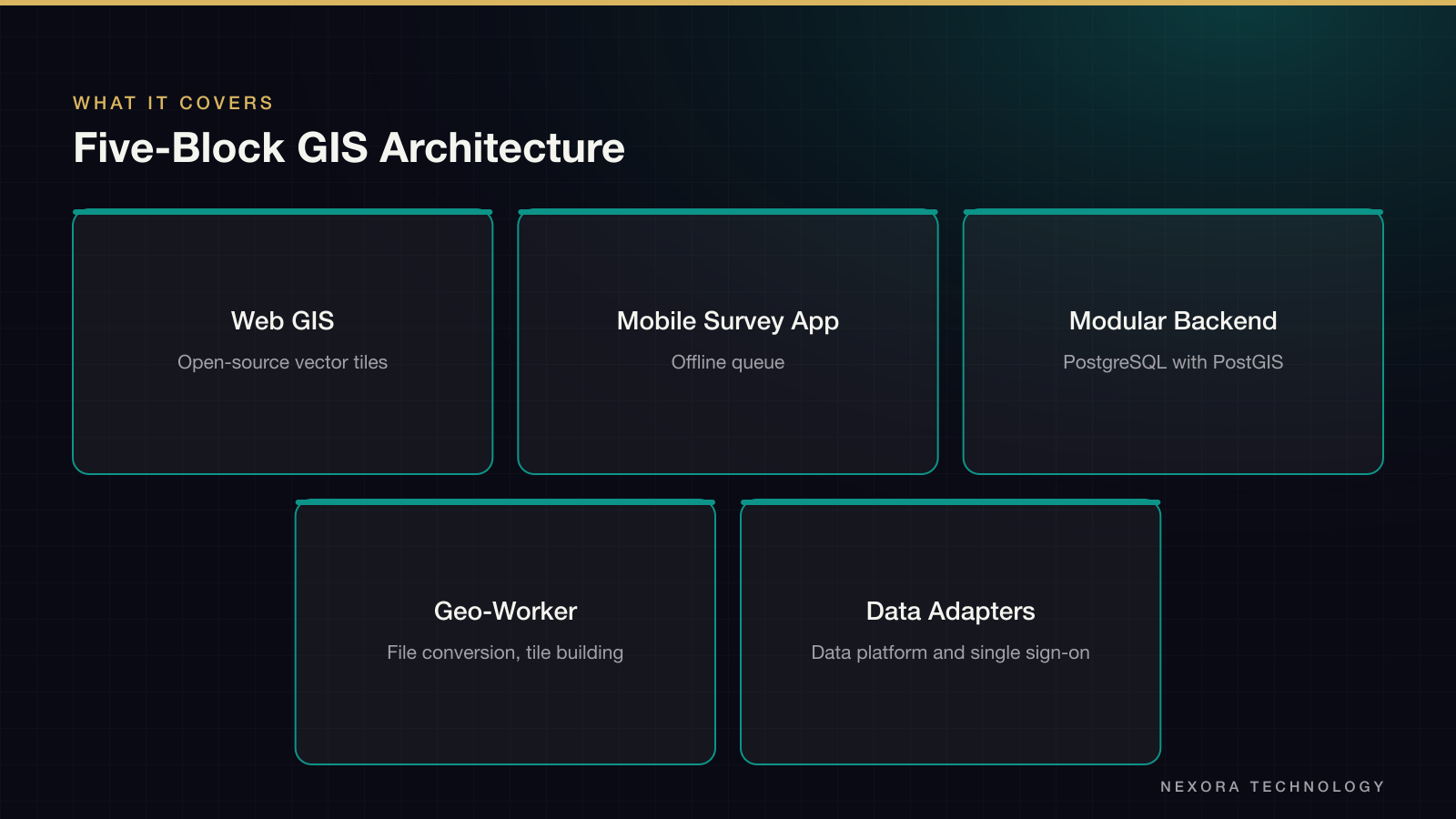
For the valuation GIS, Nexora proposed a five-block architecture that keeps the map layer apart from the business layer. Heavy parcel data is pre-built into versioned tiles, so the server computes nothing while a user pans. Asset data goes through a permission-checked API. Imports run as batches with staging, validation, approval and rollback.
- Web GIS with open-source vector tile rendering
- Mobile survey app with an offline queue
- Modular backend over PostgreSQL with PostGIS
- Separate geo-worker for file conversion and tile building
- Adapters to the partner’s data platform and single sign-on
Key Design Decisions
Matching roughly one million legacy assets to parcels is treated as a reviewed data-processing workstream, not a one-time import. Many records lack coordinates or carry inconsistent sheet and parcel numbers. Personal data is masked by role at the query layer for every output path. Where our default has a trade-off, such as static tiles versus dynamic tiles, we listed the alternative and the condition for choosing it, so the partner can confirm or overrule.
- Design targets: map opens in under 5 seconds, search under 3
- Performance measured at p95 with simulated users, cold and warm cache
- Single source of truth per field between GIS and the data platform
- Basemap sovereignty check before any international tile source is used
What the Partner Gets
The partner gets a written reading of the problem, an architecture they can challenge, and a short list of open points that need a decision before build. Nexora also showed running map prototypes built on the same open-source stack, so the proposal rests on working code and not only on slides. The next step in each case was a short technical trial on the client’s sample data, before any scope was fixed.
Bạn có một dự án tương tự?
Kể cho chúng tôi nghe. Cuộc tư vấn đầu tiên miễn phí.